Boston Public Library
David Judkins Weaver Papers
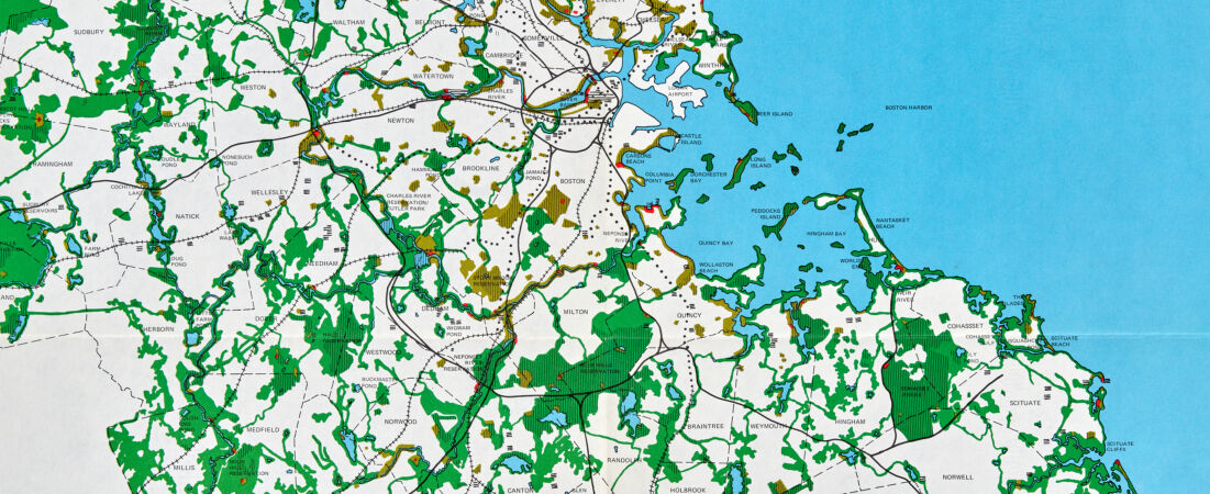
Detail from:
The regional open space system
The David Judkins Weaver papers consist primarily of maps dated 1799-2019, bulk 1970-2019, that were created or collected by David Judkins Weaver (1951-), a cartographer and geographer in Boston, Massachusetts, who worked at various companies and Massachusetts agencies from the early use of computer cartography in the 1970s through its development and increasing adoption to prevalent method of cartography in the 2010s.
The collection contains manuscript and printed maps, notebooks, books, pamphlets, documents, photographic prints, 35mm slides, and tools. It includes his professional portfolio, notes, and independently published maps; maps from organizations at which he was employed, mainly MassGIS and Applied Geographics, Inc.; his collection of traditionally published maps and computer-assisted maps; cartography reference materials; and cartography tools. A large portion of maps are of Massachusetts and New England or show coastal and environmental information.
The collection contains manuscript and printed maps, notebooks, books, pamphlets, documents, photographic prints, 35mm slides, and tools. It includes his professional portfolio, notes, and independently published maps; maps from organizations at which he was employed, mainly MassGIS and Applied Geographics, Inc.; his collection of traditionally published maps and computer-assisted maps; cartography reference materials; and cartography tools. A large portion of maps are of Massachusetts and New England or show coastal and environmental information.