Wayland Free Public Library
Wayland Historical Maps and Plans
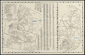
Detail from:
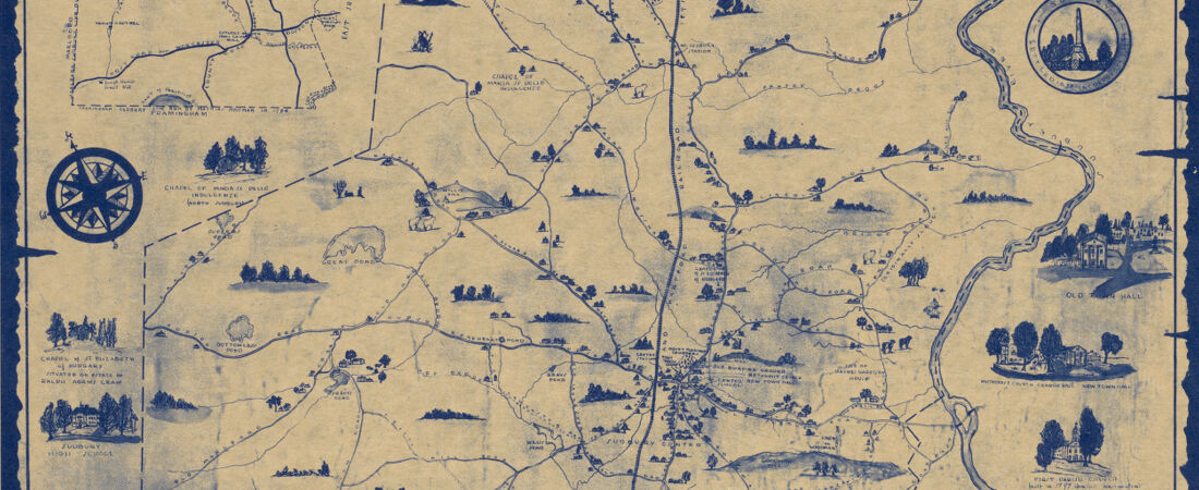
Sudbury then and now
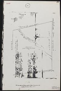
Sudbury Plantation was established in 1638 and was formally admitted as a town in the Massachusetts Bay Colony in 1639. It was the third inland community beyond the tidewater. Lands west of the Sudbury River were first settled in 1643. The land grants would eventually total 40 square miles, including land from Wayland, Sudbury, Maynard, Stow, Framingham, and Natick. Maps from the 1600s show this growth.
In 1721, the General Court created two precincts in Sudbury, which became two towns in 1780. The law at that time said the original name does not stay with the petitioner, hence the west side of the Sudbury River retained the name Sudbury, despite being the more recent settlement, and the petitioner, on the east side of the river, became East Sudbury.
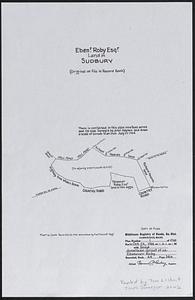
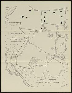
In 1835, East Sudbury changed its name again, presumably to honor Francis Wayland, president of Brown University and friend of Judge Edward Mellon, a prominent community member. The Town was growing, transportation was changing, industry was expanding, but farming was still prominent. In 1848, Wayland saw the establishment of the first free public library in Massachusetts. The meadows, which founded the town, were destroyed when a dam was built upriver. A huge legal case ensued. Maps from the period show the growth of the town and industry, as well as the legal and geographic consequences of the dam project.
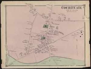
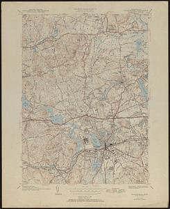
In the 20th century, the maps, plans, and blueprints show the population growth, as well as the need to revise waterworks, expand recreation for the community, improve the library, and revamp the fire station in Wayland. The topographical maps display the area in and around Wayland. Many hills are removed, open spaces filled, and location names changed. The town loses industry and farms and becomes a residential bedroom community.
Wayland maintains three historic cemeteries:
North Cemetery (1643)
South Cemetery (1835)
Lakeview Cemetery (c. 1821, formally est. 1871).
This collection contains a partial map of the oldest section of North Cemetery and South (or Center) Cemetery.
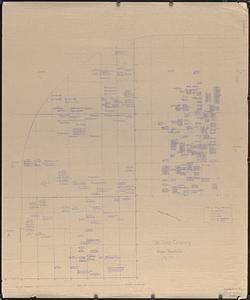
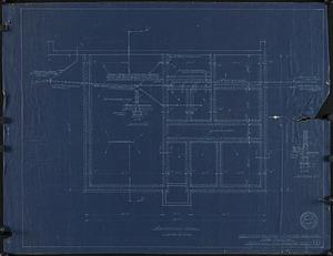
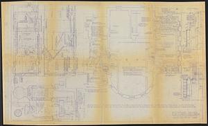
There are general-use maps at medium scales that present elevation (contour lines), hydrography, geographic place names, and a variety of cultural features. In addition, they present localities affected by the flooding of the Concord and Sudbury Rivers caused by the Middlesex Canal dam in Billerica, Massachusetts. The collection also includes a set of blueprints to expand the use of the Cochituate Village firehouse.
In 1721, the General Court created two precincts in Sudbury, which became two towns in 1780. The law at that time said the original name does not stay with the petitioner, hence the west side of the Sudbury River retained the name Sudbury, despite being the more recent settlement, and the petitioner, on the east side of the river, became East Sudbury.
In 1835, East Sudbury changed its name again, presumably to honor Francis Wayland, president of Brown University and friend of Judge Edward Mellon, a prominent community member. The Town was growing, transportation was changing, industry was expanding, but farming was still prominent. In 1848, Wayland saw the establishment of the first free public library in Massachusetts. The meadows, which founded the town, were destroyed when a dam was built upriver. A huge legal case ensued. Maps from the period show the growth of the town and industry, as well as the legal and geographic consequences of the dam project.
In the 20th century, the maps, plans, and blueprints show the population growth, as well as the need to revise waterworks, expand recreation for the community, improve the library, and revamp the fire station in Wayland. The topographical maps display the area in and around Wayland. Many hills are removed, open spaces filled, and location names changed. The town loses industry and farms and becomes a residential bedroom community.
Wayland maintains three historic cemeteries:
North Cemetery (1643)
South Cemetery (1835)
Lakeview Cemetery (c. 1821, formally est. 1871).
This collection contains a partial map of the oldest section of North Cemetery and South (or Center) Cemetery.
There are general-use maps at medium scales that present elevation (contour lines), hydrography, geographic place names, and a variety of cultural features. In addition, they present localities affected by the flooding of the Concord and Sudbury Rivers caused by the Middlesex Canal dam in Billerica, Massachusetts. The collection also includes a set of blueprints to expand the use of the Cochituate Village firehouse.